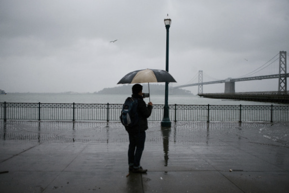
A city-commissioned environmental study that detailed how the Mission Bay neighborhood would be inundated by rising seas in coming decades went unpublished for more than a year while two showcase waterfront developments won key approvals from city officials and voters, a Public Press review of records shows.
Before the Golden State Warriors scored a win at the Planning Commission for a new bayfront arena and the San Francisco Giants got the go-ahead from voters for plans to develop housing and offices next to AT&T Park in late 2015, city agencies and the Port of San Francisco sought input from major “stakeholders,” which included the two sports franchises.
But they did not involve the district’s supervisor or the public, and did not widely distribute the June 2015 draft marked “final” before the official publication in September 2016 — two weeks after an official records request by the Public Press.
Ten months earlier, voters had approved Proposition D, the Giants’ Mission Rock development, without being given a chance to compare the developers’ ballot-box claims about resilience to sea level rise with the independently researched report laying out the need to radically re-engineer the burgeoning neighborhood.
The report describes the immediate need for public agencies to plan for massive physical barriers to protect against powerful storms and coastal flooding that are expected to increasingly threaten the city’s southeast and downtown over the next few decades. Costs will likely run into the billions, with taxpayers bearing most of the burden.
“We don’t have 5–10 years before this process can begin,” wrote the authors of the report, prepared by SPUR, a San Francisco-based planning and urban research think tank. “The catastrophic events of Katrina and Sandy show that disasters with unimaginable impacts can happen tomorrow.”
Though the report’s authors shared several drafts with the Planning Department staff, there is no record of members of the San Francisco Planning Commission having seen it before approving the Warriors arena in November 2015, not long after voters passed Proposition D. There is also no indication that drafts were shared officially with the Board of Supervisors before it approved both projects.
RELATED: Emails Show How Flood Study Became Public
Mayor Ed Lee advocated forcefully for both megadevelopments, which together would cost about $2.6 billion. His office and the port jointly requested the sea level rise study in early 2014, but missed several opportunities to bring the report into public discussions about major waterfront developments.
Three members of the city Planning Commission, which approved the Warriors basketball palace in November 2015, said they were kept in the dark about the dangers from rising seas in the city’s fastestgrowing neighborhood. Mission Bay is home to residential towers, offices, medical and research facilities, and the city’s new emergency services center.
District 10 Supervisor Malia Cohen, who represents the city’s southeastern shore, said she was not aware of the draft report’s findings before the board signed off on the Warriors’ and Giants’ plans.
“I was not consulted in the drafting of the documents,” Cohen said. “Of course, I am interested and concerned by the looming impact of sea level rise.”
Public Works Projects Foreseen
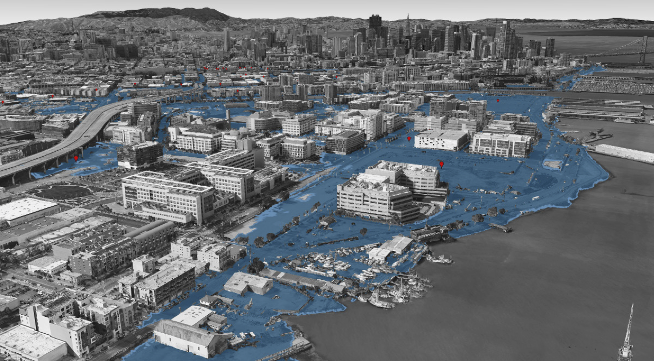
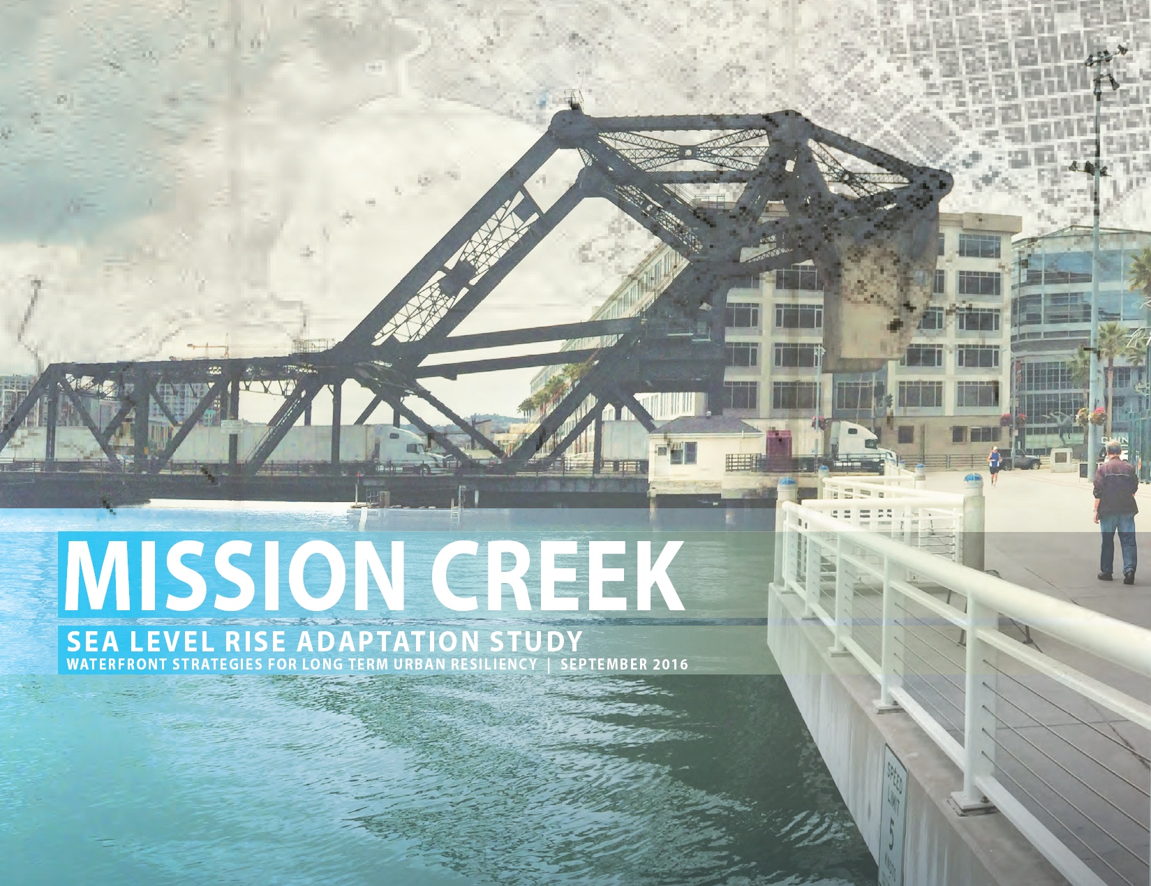
The Mission Creek Sea Level Rise Adaptation Study presented strategies for massive public works projects that might be needed to fortify the shoreline against sea level rise. Ideas included reinforcing seawalls, building a tidal gate, creating offshore structures to lessen waves’ impact and elevating Third Street as a kind of levee. In one scenario, a large section of the neighborhood closest to the bay could be retrofitted to flood occasionally. That area would include the Warriors arena.
The report cites a 2012 study by the National Research Council which found that global warming could raise bay waters above the current street level at Mission Bay in just a few decades. In an extreme scenario, builders engineering new structures could expect San Francisco Bay to rise 4.6 feet above current high tide, plus 3.4 feet of storm surge, scientists found. Much of Mission Bay lies below the 8-foot level.
The Mission Creek report warned forcefully against complacency: “The slow pace of sea level rise does not communicate a sense of impending threat; however, that danger could materialize in this community. It is urgent that work on solutions begins now because major developments in the inundation zone are currently being planned or built. It can take years or decades to conceptualize, design, earn public support, fund, permit and construct major capital shoreline projects.”
Fuad Sweiss, the mayor’s adviser on sea level rise, said the study is part of the city’s broader resiliency planning process. Its recommendations include public-works projects that would extend beyond any individual development or even the borders of the recently established 303-acre Mission Bay neighborhood.
He said the original six-month timeline for the report was overly ambitious for a project of this magnitude because it required fact-checking, consultation with many departments and new imaging data that reflected recent landscape changes made by developers.
“We were busy with so many things that were related to sea level rise,” he said. “We had so many issues. We tried to unify the work by all city agencies under one umbrella.”
Yet for all that work, the final report in September 2016 looked remarkably similar to a draft distributed to stakeholders in the summer of 2015, and contained the same core message: Mission Bay is in danger of flooding within the lifetime of buildings already in place or under construction, so the neighborhood needs to be redesigned as it is being built out.
While several Planning Department staff were involved in reviewing drafts of the report for more than two years, one member of the Planning Commission, which oversees the department and grants city approval on major developments, said he had not read the report until its publication last fall — nearly a year too late to make a difference.
Dennis Richards, the commission’s vice president, said he might have viewed the Warriors arena and other Mission Bay developments in a new light if the study had been available to the seven-member panel in 2015.
“Given that this was not available, would we have done something differently?” Richards said. “That’s the question, I think.”
By the time the report was released, the Planning Commission no longer had a chance to weigh in, and a lawsuit against the proposed arena, which the developers beat back in November 2016, was near resolution.
“What’s really funny is that all of the appeals have been exhausted — and this piece of information comes out after the appeals have been exhausted,” Richards said.
Developers Eye Early Drafts
The Port of San Francisco, the Planning Department, the Office of Community Investment and Infrastructure, and the Bay Conservation and Development Commission, among others, cofunded the $200,000 study, which was started in 2014 by a team of consultants led by SPUR, with help from the Dutch engineering firm Arcadis.
The Public Press first inquired about the publication schedule in December 2014. In an email, Laura Tam, SPUR’s sustainable development policy director, said her government counterparts told her it would be published likely in “late January or early February.” In late February 2015, she said completion was delayed further because of “technical issues.”
Reached for a comment recently, Tam said she could not recall any occasions when drafts of the report were presented to policymaking bodies.
“As the SPUR project manager of this report I can share that it did not occur to me, and would not be typical for us, to share drafts of our study with the Planning Commission or the Board of Supervisors,” she said.
AnMarie Rodgers, senior policy adviser with the Planning Department, was involved in the project until 2015. “As a SPUR report, it does not require city adoption,” she told the Public Press.
Emails from the port show that in June 2014, Brad Benson, a project manager who oversaw the Mission Creek report, asked Lee’s office in an email if he could reach out to the Warriors’ developer, Strada Investment Group. “I want to make sure they don’t have any concerns about the study,” Benson wrote.
Three months later, the Giants hosted a meeting at AT&T Park at which an early draft of the study and slides were shared with an array of stakeholders, including staff from Mission Bay Development Group and representatives from city agencies. At that time, the Giants were seeking voter approval to raise the height limit for Mission Rock, a $1.6 billion, mixed-use development with 1,500 homes along the south side of Mission Creek. That narrow channel separates Mission Bay from South of Market, and meets the bay at McCovey Cove, where home run balls make a splash.
The slides indicated that the final report would be drafted by November 2014 and published by March 2015.
On Sept. 19, Tam followed up with the group by sending the draft presentation and requesting responses to design details within a week.
“It seems important to share within your departments and teams at your judgment so that the final product is the best it can be, and our key stakeholders are not surprised by it,” she wrote.
Three days later, Tam outlined to the capital planning committee the city’s need for spending on major public works to protect Mission Bay from sea level rise.
“We cannot just protect individual buildings,” Tam told participants at the Sept. 22 session. “We need something that protects the whole area in the long term.”
The presentation made headlines — “Study: SF may need to build levee to protect Mission Bay from rising sea levels,” the San Francisco Examiner reported. But the draft report was not released.
Later that fall, the project team began to further involve department heads and developers to “take more time to get people bought in to what we are doing,” Arcadis consultant Peter Wijsman wrote in an October 2014 email to Tam and Benson.
Eight months later, in June 2015, a version of the study stamped as a “final draft” was circulated to the stakeholders group and the University of California, San Francisco.
Fran Weld, the Giants’ vice president of development, said the team was “able to learn from the process.” She said the 28-acre Mission Rock site would be re-engineered and could function as a levee. The Giants’ plan to raise the buildings to 5.5 feet above today’s mean high tide, surrounded with graded parks that drain to the streets and the bay. She said a Mello-Roos tax — a special neighborhood-based real estate surcharge — would help pay for future sea rise protections.
“We know we don’t know everything that will happen with climate change today,” she said, “so we are doing the best we can today and structuring the financing for what we don’t know in the future.”
Luring Basketball Back to S.F.
For the Warriors’ dreams of returning to San Francisco, the second time was a charm.
In April 2014, the team’s brass abandoned its initial plan for an arena on Piers 30-32 near the Bay Bridge after it generated fierce political opposition from neighbors concerned that it would create congestion and block views. Instead, the team purchased its current 12-acre site in Mission Bay from cloud-computing giant Salesforce. Developing on a private plot instead of port property directly on top of the water eliminated the need for voter approval as well as reviews by the Bay Conservation and Development Commission and the U.S. Army Corps of Engineers.
“We just have to deal with the city agencies, and that’s a lot simpler, quite frankly,” Warriors co-owner Joe Lacob told the San Jose Mercury News.
In December 2014 — a few months after the study began — Strada Investment Group received a draft to review.
On Dec. 12, Benson emailed Strada executives about the adaptation study and design concepts. “We would very much like to share these with you to get your feedback, as the study area includes the arena site at its southern boundary,” Benson wrote.
In a recent interview, Benson qualified that communiqué, saying he merely wanted to alert Strada to the existence of the study.
“We didn’t get any feedback from the Warriors,” Benson said.
Strada representatives did not respond to repeated requests for comment. The team has said it would raise buildings and waterproof below-ground features. Environmental documents acknowledged that during a storm the main court, practice courts and parking garage could be flooded as soon as 2100, if the more pessimistic scientific predictions hold true.
Benson said that he shared drafts with Planning Department staff, and that it would have been their responsibility to bring it to the commission. He described the Mission Creek study as a “thought exercise” to develop a range of concepts. “I think it will serve the public education function as it was intended,” he said.
“The purpose of the report was never to inform development proposals,” Benson said. “It was not to inform development in Mission Bay. It was to look at the shoreline — what will happen to the shoreline over the next 50 or 100 years? It is a concept document.”
But the study itself warned that large sections of the neighborhood, including the areas where the teams are building, would need expensive retrofits.
Catherine Reilly, with the city’s Office of Community Investment and Infrastructure, suggested in one email “that we set the tone” with “solution graphics” that are “attractive for reprint in a news article so that we do not only end up with the ‘sky is falling’ flooding map and the story of solutions is lost.”
The mayor did seem concerned about the dangers of sea level rise to the megadevelopments he was pushing hard for in Mission Bay. In fact, his staff was working on multiple, parallel tracks to study the problem.
In March 2015, Lee convened a citywide committee to coordinate sea level rise planning across departments. About year after that, the panel published an “action plan” for assessing flood risk for public buildings. That document received only a half-sentence mention in the Mission Creek study.
But it did make a promise: A follow-up report would be completed by summer 2018 that would detail funding strategies and possibly new regulations on land use.