By Barbara Grady, Oakland Local/New America Media
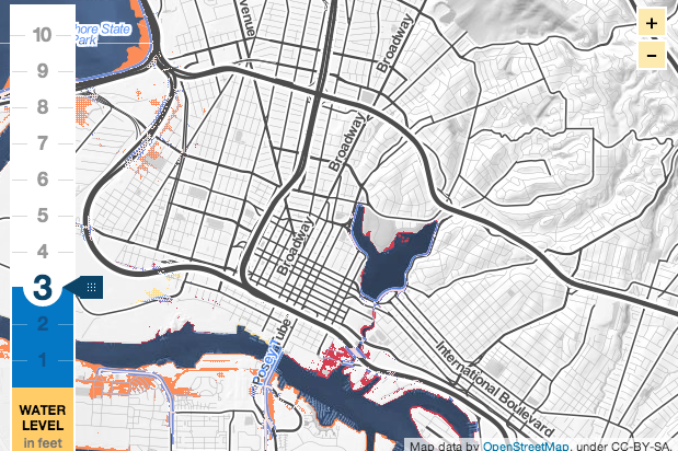
The shoreline along Oakland is a checkerboard quilt of cement, steel and wetlands, with grassy estuaries sandwiched between walls of cement where old terminal buildings rise from the shore, steel pipes send effluent to the San Francisco Bay, and massive container ship berths receive their payload. Just inland from this quilt lies a broad north-south strip of railroad and highway.
Only after all that, nearly a mile from the shore, lie residential neighborhoods, block after block of shoebox-size houses in an area known locally as the flatlands. Their distance from the shoreline leads many Oakland residents into thinking of sea level rise as a remote issue not likely to affect them – a finding based on random interviews when a question about flooding caused people to laugh or raise an eyebrow and point to the scorching sun in drought-worried California.
Read the complete story at New America Media.